|
Auktionshaus Kiefer
Steubenstraße 36
75172 Pforzheim
Telefon 07231 / 92 32 0
http://www.kiefer.de
Auction 133:
Translator:
Auction 75
Context information


|
|
Search items
facebook
Kiefer.de - Newsletter
|
You are actually browsing a previous auction.
Items shown are not availble to buy or to place a bid.
75-4668 Schenk,(P.) u. G.Valck.
Atlas contractus sive Mapparum Geographicarum Sansoniarum auctarum er correctarum Nova congeries. 5 Bände. Amsterdam, P.Schenck (Pieter Schenk u. Gerard Valck, 1708). Imp.Fol. (530 x 330 mm.). Mit 474 alt flächenkolorierten doppelblgr. Kupferstichkarten. Hldrbde. d. 18. Jhdts. (Gebrauchssp., tls. beschäd.).
Schöner Sammelatlas aus dem Verlag von Schenk u. Valck unter Verwendung der von Janssonius übernommenen Karten des Novus Atlas, nahezu exakt entsprechend der bei Koeman (Bd. III, S. 111f.) gegebenen Aufstellung (471 Karten enthaltend) aus der Herzog August Bibliothek, Wolfenbüttel aber ohne den Atlas Coelestis von Cellarius. Koeman bemerkt, daß mit der Neuausgabe der Karten aus Janssonius' Novus Atlas seit etwa 1680 die Herstellung neuer Karten einherging, die von Sansons besseren und moderneren Karten kopiert wurden. So enthält die vorliegende Sammlung zahlreiche neue Karten mit dem persönlichen Impressum von Schenk (die späteste seine "Hollandiae Borealis" datiert 1708), Valck und Frederick de Wit. Die drei Weltkarten sind von van Loon (mit Schenk u. Valck Impressum), die van den Keere Mercator Karte mit Bordüre im Moses Pitt Zustand und die Blaeu/Valk Polarhemisphären-Weltkarte, während die Karten der 4 Kontinente von Schenk sind. Band 1 beinhaltet u.a. Janssonius' Atlas of the British Isles" in einer unregistrierten Auflage zwischen den Hodson Nummern 130 (vor der Nennung von Schenk u. Valck im Impressum und anderer Änderungen) und 131, 1714 verlegt von David Mortier (einige Janssonius-Karten durch Blaeu-Karten ersetzt). Die Karten enthalten die für 131 angegebenen Änderungen, enthalten aber nicht die für diesen Atlas genannten gestochen Plattennummern. - Der vorliegende Atlas ist bemerkenswert für die Qualität des zeitgenössischen Kolorits und den Erhaltungszustand der Karten und bildet so ein hervorragendes Muster eines Holländischen Atlas' des ausgehenden 17. Jahrhunderts. Band 1 beinhaltet die Weltkarten, Europa, Skandinavien und die Britischen Inseln. Band 2 enthält die Niederlande und Deutschland; Band 3 Deutschland und Frankreich; Band 4 Frankreich, Spanien und Italien; Band 5 Ungarn, Asien, Afrika und Amerika. - In Band 4 fehlt die Karte von Sardinien, an ihrer Stelle ist die Karte von Korsika doppelt vorhanden. Außerdem enthält der Atlas das Titelblatt des "Atlas contractus", das für einen Atlas dieses Umfangs wohl nicht vorgesehen war. Einige ger. Wurmspuren, 2 Karten in Bd. 1 betreffend, Karte 35 (Tabula Moscoviae, mehrf. gefaltet) ausgerissen u. mit Einrissen in d. Falzen. Vereinzelt knickfaltig u. tls. Heftung gelockert, tls. ger. Läs. Stellenweise etw. fleckig u. wasserrandig. - Fine composite atlas, published by Schenk and Valk, composed of map-plates acquired from the stock of Johannes Janssonius, comparable with the catalogue quoted in extenso by Koeman, but without the Cellarius Atlas Coelestis volume mentioned. Koeman suggests the partners were "republishing the maps from Janssonius's Novus Atlas since ca. 1680"; however this collection contains numbers of new maps with the individual imprint of Schenk (the latest his 'Hollandiae Borealis' dated 1708), Valk and Frederick de Wit. The three world maps are the van Loon world with Schenk and Valk imprint, the van den Keere Mercator map of the world with panelled borders, in the Moses Pitt state, and the Blaeu/Valk polar hemisphere world, while the maps of the four continents are by Schenk. - Volume 1 contains the Janssonius atlas of the British Isles, in an unrecorded "edition", intermediate between Hodson's 130 (prior to the addition of the Schenk and Valk imprint, and other revisions) and 131, published by David Mortier in 1714 (with some of the Janssonius maps replaced by Blaeu maps). The examples here have the revisions called for under 131, but lack the engraved plate numbers called for in that atlas. - This atlas is remarkable for the quality of the contemporary colour, and the internal condition, and is an outstanding example of a late seventeenth-century Dutch atlas. Volume 1 contains maps of the world, Europe, Scandinavia and British Isles Volume 2 - Low Countries and Germany Volume 3 - Germany and France Volume 4 - France, Spain and Italy Volume 5 - Hungary, Asia, Africa and the Americas. - Folio (530 x 330mm.), 5 volumes, engraved allegorical title, manuscript indexes in volumes 1, 4 and 5 inserted at beginning of each volume, 474 mostly double-page engraved maps with contemporary body colour, [Koeman, III, p.111 (the catalogue) and p.109 for comments on the Janssonius items], eighteenth-century half, some marginal worming just affecting 2 maps in volume 1, map 35 (Tabula Moscoviae) torn, occasional light offsetting, bindings worn. Abbildung siehe Tafelseiten

|
Next auction 133 takes place in May 2.-4., 2024
NEW:
KIEFER Pforzheim
Tel. +49 (0)7231 / 9232-0
Similar items
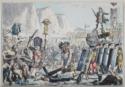
133-1642 A'Beckett,G.A., 120,00 €
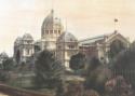
133-1625 Views, 1.800,00 €
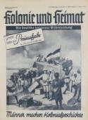
133-1650 Nationalsozialismus., 50,00 €
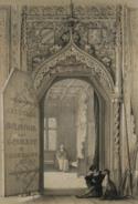
133-1620 Imbert des Mottelettes,C., 133,00 €
133-1673 Russland., 120,00 €
|
|
|